Appendix b. locr gps photo – Transystem 747Pro User Manual
Page 26
Advertising
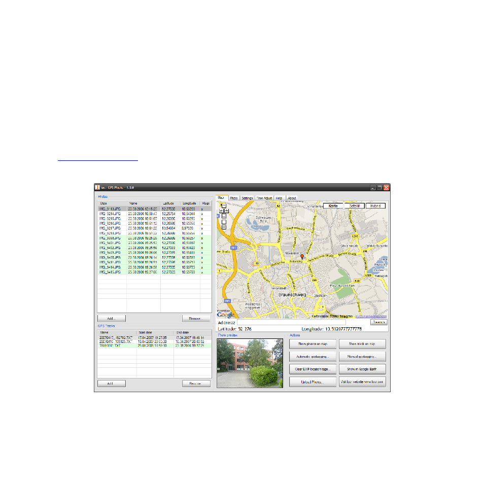
Appendix B. locr GPS Photo
With 747Pro and locr GPS Photo software, users are allowed to import geotagging adds
information to photos. The position (latitude/ longitude) then be written into the EXIF header
for the further application. Also, locr GPS Photo can integrated travel log and digital photos
by date/ time to show photos on the map directly.
Please find the installation file for Windows XP/ Vista in CD tool, or go to
ation.
26
Advertising