NDrive 10 for phones User Manual
Page 40
UG-N10PH-01-EN-EN-201005
39
Navigation screen
(1) Available on selected maps
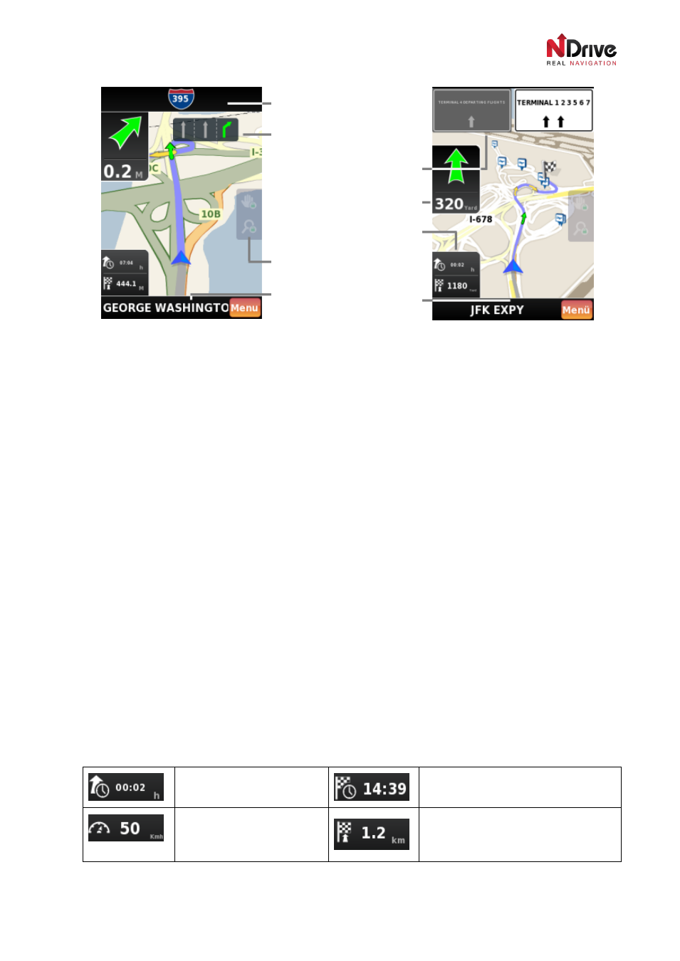
Your position is displayed as a blue/green three-cornered indicator. On the screen you will also see a
green flag (representing your starting point) and chequered flag (representing the end of your route).
There is also a lot of additional information that can be displayed on the navigation screen. Some of this
was described in the
Map Interface section. In addition, you can find some special fields with
information useful only during driving. The full list of fields is presented below (please refer to the
illustration above):
1. Top Display area - usually displays the name of the street following the next manoeuvre or
direction.
2. Lane Assistance (displayed occasionally) – indicates the lane that you should choose in order to
follow the calculated route.
3. Signpost (displayed occasionally) – shows signposts on roads.
4. Next Manoeuvre area – shows the distance to the next manoeuvre (in miles, yards, kilometres,
meters, feet etc.) and its type (represented by the green curved arrows).
5. Time, distance and speed indicators (see the full list below)
6. Lock buttons: zoom and pan
7. Bottom display area – showing the name of a current street, country-road and system information
To make it as simple as possible, NDrive lets you to choose what you would like to have presented on
the screen. Tapping the
time, distance and speed controls you can choose to display different
indicators. Below, you can find the complete list of all available indicators:
Estimated time left to
destination
Estimated time of arrival to
destination
Speed limit on the current
street
Distance left to destination or way-
point
Top display area
Lane assistance (1)
Signposts (1)
Next manoeuvre area
Time/distance/speed indicators
Lock buttons: zoom/pan
Bottom display area