Gps info window screenshot – NEXCOM VMC 100 User Manual
Page 32
Copyright © 2014 NEXCOM International Co., Ltd. All rights reserved
18
VMC 100/1100 Series User Manual
Chapter 2: Using the GPS Feature
•
“WAAS/EGNOS” - Check the box to activate WAAS/EGNOS in order to
increase the accuracy of positioning
•
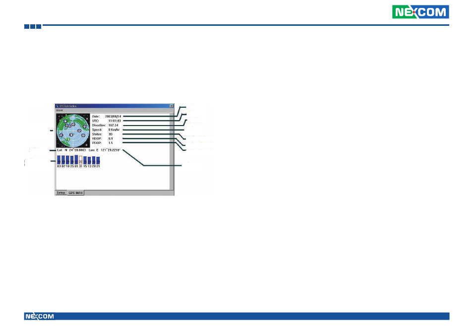
“Main GPS data Window” - Display data received by GPS device.
GPS Info Window Screenshot
•
“Satellite Distribution Map” – Display the position of all connected
Satellites
•
A unique number is assigned to each satellite.
•
Red circle indicates that the satellite location is known from almanac
information; however, the satellite is not currently being tracked.
•
Green circle indicates that the satellite is being tracked; how ever, it is
not being used in the current position solution.
•
Blue circle indicates that is being tracked and is being used in the cur-
rent position.
Satellite
Distribution
Map
Latitude
Satellite Status
Chart
Longitude
Position Accuracy
Horizontal Accuracy
Positioning Status
Speed
Direction
Time
Date
•
“Latitude” – User’s current latitude is displayed in N/S degree (North/
South Hemisphere) format
•
“Satellite Status Chart” – display the status of each connected satellite
•
The number under each bar marks corresponding Satellite, and the
height of each bar represents the strength of the satellite.
•
Red bar indicates that the satellite location is known from almanac
information; however, the satellite is not currently being tracked.
•
Green solid bar indicates that the satellite is being tracked; however, it
is not being used in the current position solution.
•
Blue bar indicates that the tracked and is being used in the current
position.
•
“Date” – display the current date in (dd/mm/yy) format.
•
“Time” – display the current (UTC) time in (hh:mm:ss) format.
•
“Direction” – display the current direction from 000.0° to 359.9°
•
“Speed” – Display the current moving speed in km/hour
•
“Positioning Status”- Three Modes
1. No Fix
2. 2D Positioning
3. 3D Positioning
•
“Horizontal Accuracy” - Range from 0.5 to 99.9, the smaller the better
•
“Position Accuracy” - Range from 0.5 to 99.9, the smaller the better
•
“Longitude” – Display current longitude in E/W (East/West Hemisphere)
Time (hhmmss)