Codan Radio Radio Repeater Systems Training Guide User Manual
Page 44
TRAINING GUIDE | RADIO REPEATER SYSTEM
Appendix A: Drawing Coverage Maps
Page 36
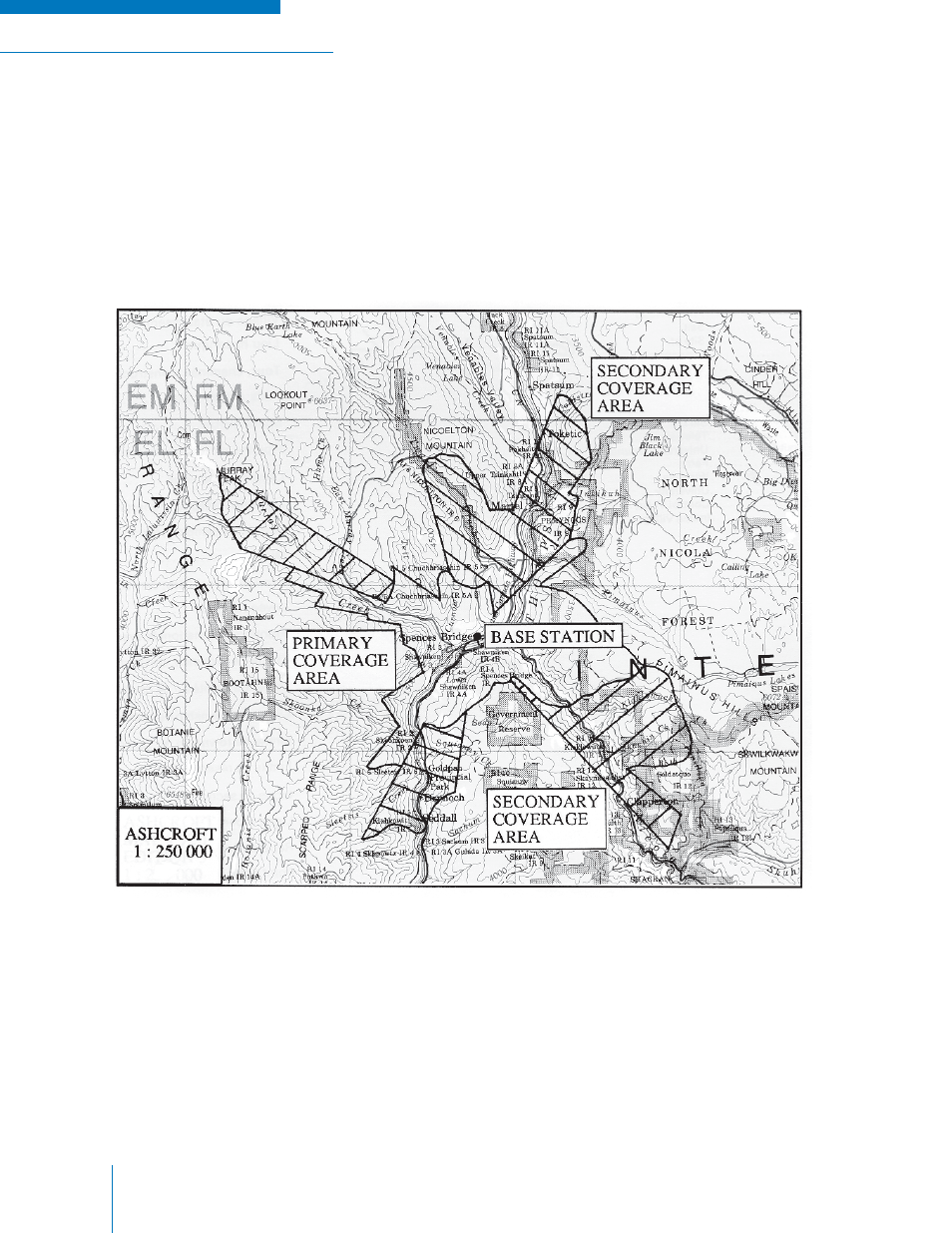
To draw a proper coverage map a 1:250,000 topographic map should be used. On the 1:250,000
topographic map mark your proposed or existing site. Next draw a circle with a radius of 50 km (30
mile) using the scale on the map. Then, imagine yourself standing on the site and draw in soft pencil
what you would be able to see. For example, if you were standing on a proposed site you would be able
to see to the tops of the mountains in your foreground, but would be unable to see those behind. You
would also be able to see up some valleys but your viewed area would narrow with distance. A proper
coverage map of the BRIDGE Base Station (shown in Figure A-2) shows areas of good coverage and
sometime coverage more accurately. If coverage areas outside of the range of this base station were
required, a repeater site could be installed at a high point for greater coverage.
Figure A-2: BRIDGE Base Station Mobile Coverage Map