Moving map display, Moving map data, Zoom and pan options – Rosen Aviation 0603 Series : Rosenview MX User Manual
Page 11
Rosen Aviation
RosenView MX
Document Number: 106284
Revision: A
Date: 12/18/13
Template: 4.4.1.6FM2; Revision A; 12/06/12
Page 11 of 20
4. MOVING MAP DISPLAY
4.1. Moving Map Data
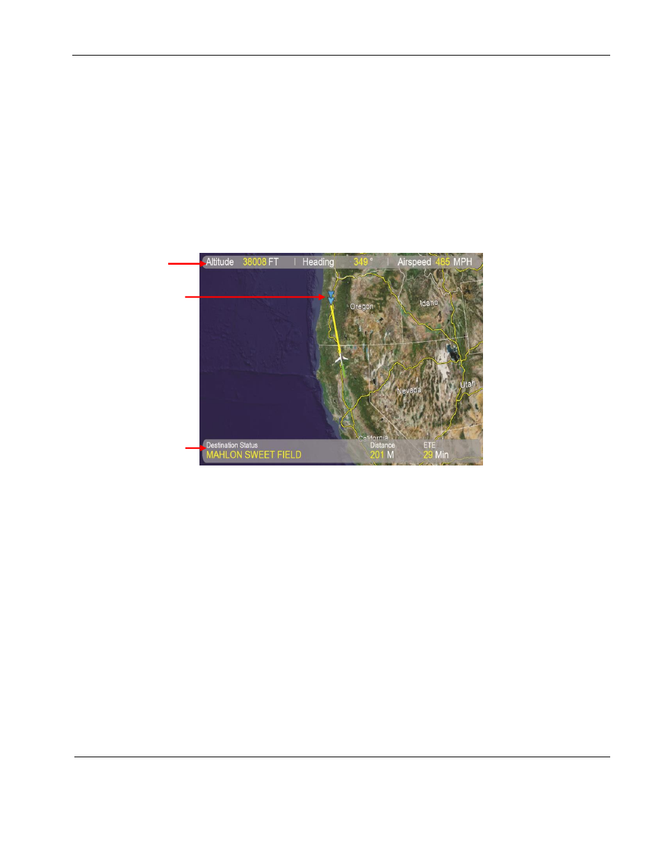
The following figure shows a medium-altitude satellite image of a moving map with typical flight
data and the default option settings. While the RosenView MX receives flight data, the
information banners on the map views may initially be blank or say
“Waiting for data...” If a data
parameter is not available, the associated data field will not display.
The flight data displayed in the information banners depends on the setting options in the
configuration file. The Destination Airport parameter is required to see the flight path, but the
maps do not require it.
Figure 2 Moving map view with flight data
The lower banner displays in one of two data formats:
Dist/ETE
– displays the flight distance and estimated time en route (time until arrival)
Local Time
– the time at the destination airport
4.1.1. Zoom and Pan Options
Nine zoom levels of satellite imagery are available to view map data. To change the map
level once you reach the lowest- or highest-level maps, press Zoom for the opposite
direction.
As long as the RosenView MX receives continuous Pan commands from a controller
within the preset timeout period, the map will not cycle to the next view.
Upper
banner
Dist/Time format
in lower banner
Destination
Symbol