User input, Figure 4: rinex converter user input area – NavCom Rinex Utility Rev B User Manual
Page 12
RINEX Utility – Rev B
After selecting a location to save the RINEX files, click OK.
Options are not always necessary to complete the conversion. Entering User Input or
Option data updates the RINEX header with user specific information. To skip the
Options menu, simply click the START button and the RINEX files will be generated
without any USER INPUT data or OPTIONS being entered, however the RINEX
observations file header will only show the default information shown in Table 1.
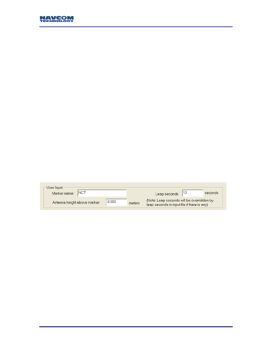
User Input
Figure 3 depicts the User Input area of the RINEX Utility. Completing these fields is
optional. Entries in these fields will be included in the RINEX observations or ephemeris
file header.
Marker name: This field allows up to 60 characters to identify the site where the
data was collected.
Leap seconds: This field allows the user to insert the current GPS Leap Second
value, if known. If left blank no leap second value will be reported in the
RINEX ephemeris (navigation) file header, or the RINEX Utility will use
the leap second time reported in the raw data file (if one exists). If the raw
data file has a larger leap second value reported than the user entered
value, the raw data file value will be used instead.
Antenna height above marker: This field allows the user to insert antenna base height
above the survey point. This adjustment can often be made in the Post Processing
Software package as well.
Figure 4: RINEX Converter User Input Area
4