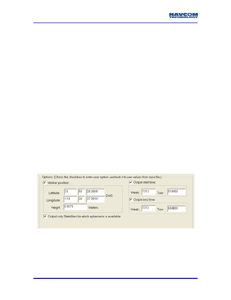
Options, Figure 5: rinex converter options area – NavCom Rinex Utility Rev B User Manual
Page 13
RINEX Utility – Rev B
Options
Figure 5 depicts the Options area of the RINEX Utility. To modify an option, the box
above and/or to the left must be “checked” (
9).
Marker Position: When enabled, allows the user to input the Latitude,
Longitude, and Height of the surveyed position in Degrees Minutes and
Seconds. These coordinates are converted to Cartesian ECEF format
and inserted into the “Approximate Position XYZ” area of the RINEX
observation file. If left disabled, the RINEX Utility will average the position
based on the range measurements received from the total number of
epochs in the data collection period.
RINEX Utility conforms to RINEX Standard 2.10, which states that the Cartesian
ECEF position in the observation file header is WGS84. This means that the height
entered in the RINEX Utility must be WGS84. The RINEX Utility makes no attempt to
convert other datum heights to WGS84. Using height data from a datum other than
WGS84 will result in errors in the Z-axis.
Output start time / Output end time: When enabled, the Output Start and
Output End times allow the user to parse a large raw data file into a
smaller snap shot of the overall data collection period.
Caveats are that the GPS week number (0 – 1023), and the GPS Time Of
Week (TOW in seconds 0 – 604800) be entered. If disabled, the RINEX
Utility will process the entire data collection period.
Ephemeris Output: When enabled, outputs the ephemeris (navigation) file, but
only ephemeris data for those satellites that have been tracked over the
data collection period. If disabled the ephemeris file will contain data on
all satellites.
Figure 5: RINEX Converter Options Area
5