MacroSystem Columbus User Manual
Page 19
18
19
5. Application examples
We recommend that you work through the fol-
lowing application examples in order to familiar-
ize yourself with how Columbus works.
The example exercises and tips do not of course
relate to all the functions included in the pro-
gram. However, they do provide you with a
good starting point from where you can easily
learn to recognize and use the other functions
after a little practice. For further details on the
functions of individual buttons and controls,
please refer to the previous chapter. The exam-
ples have been specially put together for new-
comers to the program and therefore introduce
you slowly to the various controls. Afterwards,
we recommend you try out your own ideas.
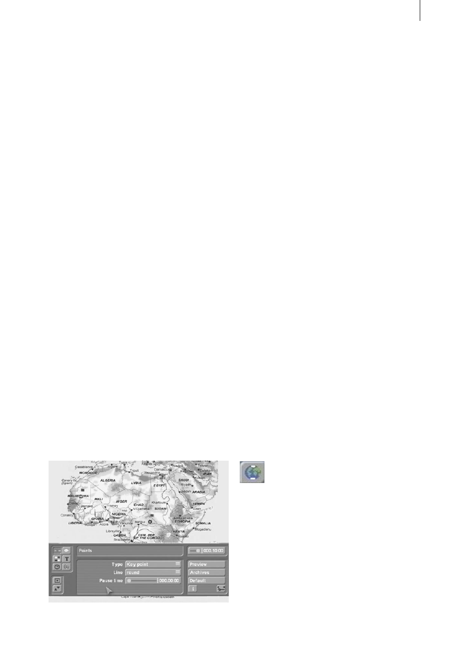
5.1 Creating a route
In this example you will learn how to operate the
Columbus program, how to use simple effects
and how to create a simple route traced out by a
hand symbol.
Open the “Edit” menu and either select a map
of the world that you have imported yourself
or use a map from the image pool. Open the
“Special” menu, select “Columbus” and click on
„Start program“.
You will now see your map in full screen mode
and the Columbus toolbar appears in the fore-
ground.
If you have already configured some of the
program settings earlier on, please click on the
“Default” button and answer the confirmation
request with “Yes“. You will see a yellow diago-
nal line that has a starting and finishing point
each labeled with a little flag.
Now click once on the green starting point (on
the left) so that it turns blue. You can now move
it by rolling the trackball. Position the point any-
where near the left edge of the screen (e.g. on
the city of Casablanca) and click on the left track-
ball button again to confirm the new position.
Next, click twice on the finishing point so that
it first turns green and then blue. You can now
move it to a city near the right edge of the
screen (e.g. on Kairo). Afterwards, confirm the
new position by clicking on the left button again.
Next, position the trackball pointer over any
position on the yellow line and click on the left
trackball button. You will see that a new point
has been set. Repeat this procedure a few more
times until you have several points evenly dis-
tributed along the line.
Now click on one of the points that you have
just set. If it is red, click on it twice so that if first
turns green and then blue. If it is already green
(i.e. active), just click on it once.
The blue point can now be repositioned in the
same way as you moved the starting and finish-
ing points. Position the points one after another
on your map so that you create a few stopovers
in other cities (e.g. Dakar, Lagos, Nairobi, Addis
Ababa).
Now open the “Global settings” menu by click-
ing on the following symbol.
In this menu, set the top selection button to
“Head object”, activate the “Show head ob-
ject” function and click on “Select head object”
to choose a symbol for the leading end of the
growing line. In the selection window that then
appears, you will see 2D and 3D objects (can
be set under “Type”) of which some are better
suited for use as key points and others as the
head object.
Select the “Right hand” symbol (3D object),