Offline mapping tools, Offline campus manager, Blue alert – Code Blue BLUE ALERT MNS MASS NOTIFICATION SOFTWARE User Manual
Page 41: Your place your way, User guide
Your Place Your Way
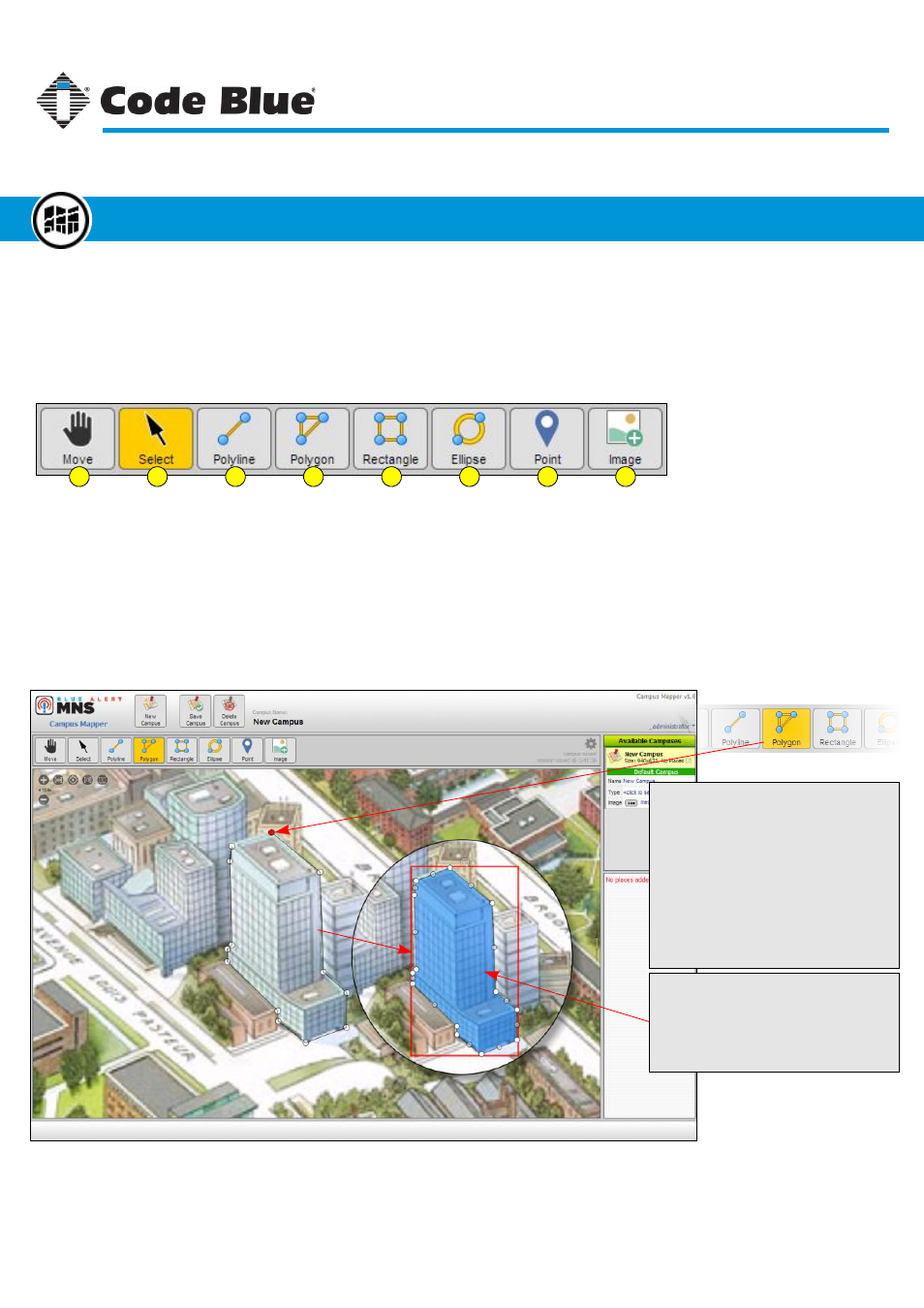
To define a place on the map, select one of the tools from the toolbar. Place tools include poly shapes,
map markers, and images used like icons. This variety helps define many different types of shapes
found in maps and floor plans. Below shows an example of adding a polygon around the shape of a
building.
1
2
3
4
5
6
7
8
1. Move Mode
2. Select Mode
3. Polyline
4. Polygon
5. Rectangle
6. Ellipse
7. Point
8. Image
Use the mouse cursor or your finger on touch screens to move the map around the campus
Use the mouse cursor to select an object or move the map image
Draw an unclosed, node-based line on the map
Draw a closed, node-based shape on the map
Draw a 4-point, closed shape on the map
Draw an ellipse shape on the map
Place a point (marker/pin) on the map
Place a selected image on the map
Draw a Polygon
Click the polygon tool and begin placing
nodes around the map object you want to
define.
Once the object is outlined, close the
polygon by clicking on the first node
created. You can also double-click the
last node to close the shape.
Note the first node created will be red
and not white like the following nodes.
The Final Polygon
Once the polygon is closed, it will be filled
with the last used color. The shape’s
opacity will default to 60%. Both the color
and opacity can be changed from the
settings panel (see next page).
Code Blue
●
259 Hedcor Street
●
Holland, MI
●
4923 USA
●
800.205.7186
●
www.codeblue.com
Rev 1/2015
page 41
User Guide
Blue Alert
®
MNS
Offline Mapping Tools
Offline Campus Manager
GU-141-C