Navigational mode – Becker TRAFFIC ASSIST 7926 User Manual
Page 42
42
>>>
NAVIGATIONAL MODE
> D
> GB
> F
> I
> E
> P
> NL
> DK
> S
> N
> FIN
> TR
> GR
> PL
> CZ
> H
> SK
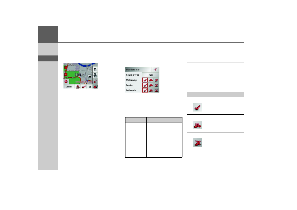
Displaying destination on the map
Once the destination has been entered,
you can display it in the map of the sur-
rounding area.
> Press the
In map
key to display the des-
tination selected on the map.
Options for the drive profile
You can set your drive profile in the Op-
tions settings window. The setting made
here impacts on the calculation of the
probable journey times and the distance.
> Select the mode of travel by repeatedly
pressing the field at the top left.
> Select one of the following options by
pressing the field on the right next to
the
Routing type
display.
With the buttons next to the fields
Motor-
way
,
Ferries
and
Toll roads
, you can set
one of the following options.
Setting
Meaning
optimum
With this option, the op-
timum route in terms of
travel time and mileage is
calculated.
fast
With this option, the
shortest route possible
for the time required is
calculated.
short
With this option, the
shortest route is calculat-
ed in terms of kilometres
travelled.
scenic
With this option, the
most scenic route is cal-
culated.
Setting
Meaning
Allowed
With this option, the
corresponding road type
is included in the route
calculation.
Avoid
With this option, wher-
ever possible, the corre-
sponding road type is
avoided.
Not permitted With this option, the
corresponding road type
is not included in the
route calculation.