Gps sensor – NavCom RT-3020 Rev.A User Manual
Page 24
RT-3020 User Guide
3-22
There should be an unobstructed view of the sky above
a 10-degree
elevation mask
for optimum
GPS
satellite
visibility for
RTK
use. Any obstructions above the
horizon should be mapped using a compass and
clinometer and used in satellite prediction software with
a recent satellite
almanac
to assess the impact on
satellite visibility at that location. Potential sources of
interference should be avoided where possible. Example
interference sources include overhead power lines, radio
transmitters and nearby electrical equipment.
Calculating the
azimu h
and
elevation
of these from a
known
latitude
,
longitude
and height can be
determined from
t
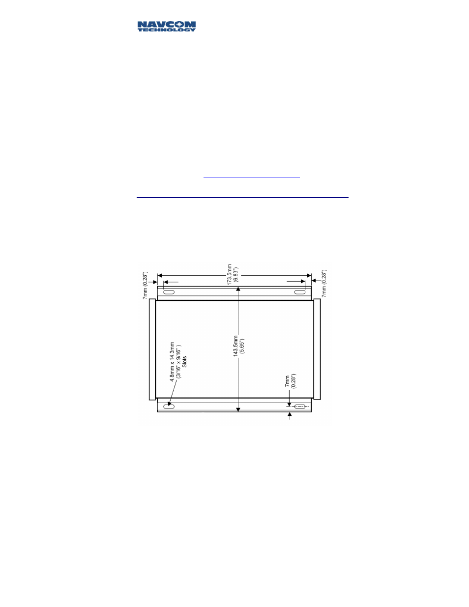
GPS Sensor
The RT-3020
GPS
sensor can be mounted to a flat
surface using four screws spaced as per the following
diagram of the base plate. In environments with high
vibration, shock absorbers suitable for 1.8kg (4lbs)
should be considered.
Figure 7: RT-3020 Base Plate Dimensions