Interactions with the map screen, In this section you will learn, First look on the map – NDrive 10 for phones User Manual
Page 7
UG-N10PH-01-EN-EN-201005
6
INTERACTIONS WITH THE MAP SCREEN
In this section you will learn…
•
What types of information can be displayed on a map.
•
How to interact with a map using the touch screen of your phone (when available).
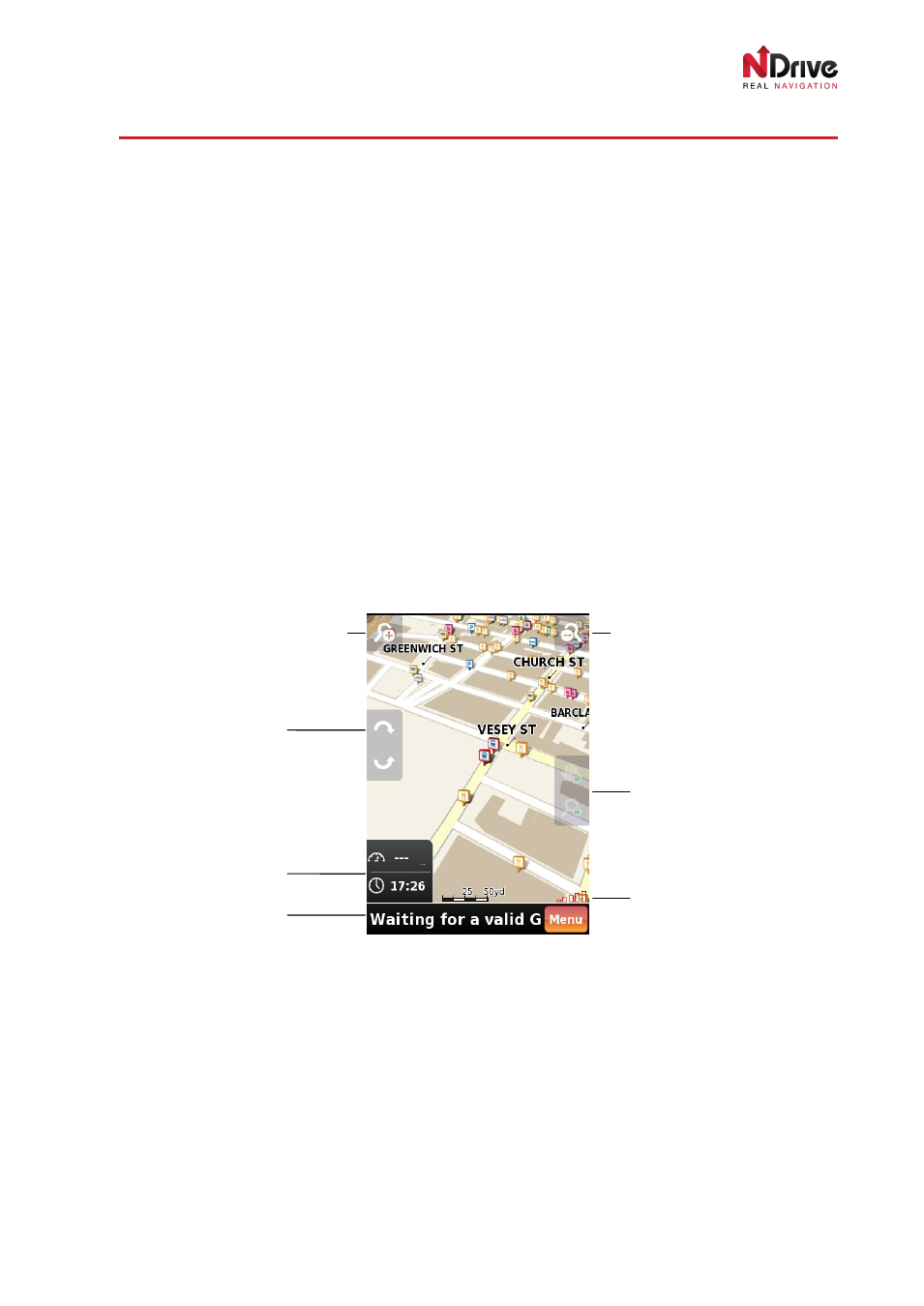
First look on the map
Map overview
On the
Map-Display Screen you will find all important information needed to navigate. Roads, parks,
lakes, rivers and urban areas are all presented in very intuitive way. Amongst all of them, users can find
on the map small colourful icons representing Points of Interest and, in some maps, 3D buildings* and
radar (safety cameras) positions. You can tap any POI icon to get more information about it. You can
also point to any other place on the map to get information about the name of the street, 3D building or
to find the coordinates of the place.
* may be hidden on devices with low performance.
The most important information and meters that you can find on the map are presented on the following
screens.
First look on the map – waiting for GPS signal
When you click
Menu, you will go directly to the Main Menu, where you can manage your settings, find
new places or start navigation.
When your position is locked on the map, you will see it indicated by a green pointer. Tap on the map
for more options:
Zoom in button
Zoom out button
Map tilt buttons
Time/speed/distance
controls
Bottom display field
Map pan/zoom
lock/unlock
GPS signal strength
bar