Setting geofences – Sony AG-R2 Attachment Grip User Manual
Page 86
Airpeak S1
ARS-S1
Setting geofences
Flight restrictions such as flight area or maximum altitude can be defined as geofence zones for each project. Warnings
are displayed on the flight screen in the “Airpeak Flight” App when the aircraft approaches the boundary of a geofence
zone while in flight. You need to sign up for “Airpeak Plus” (paid plan) to use geofences.
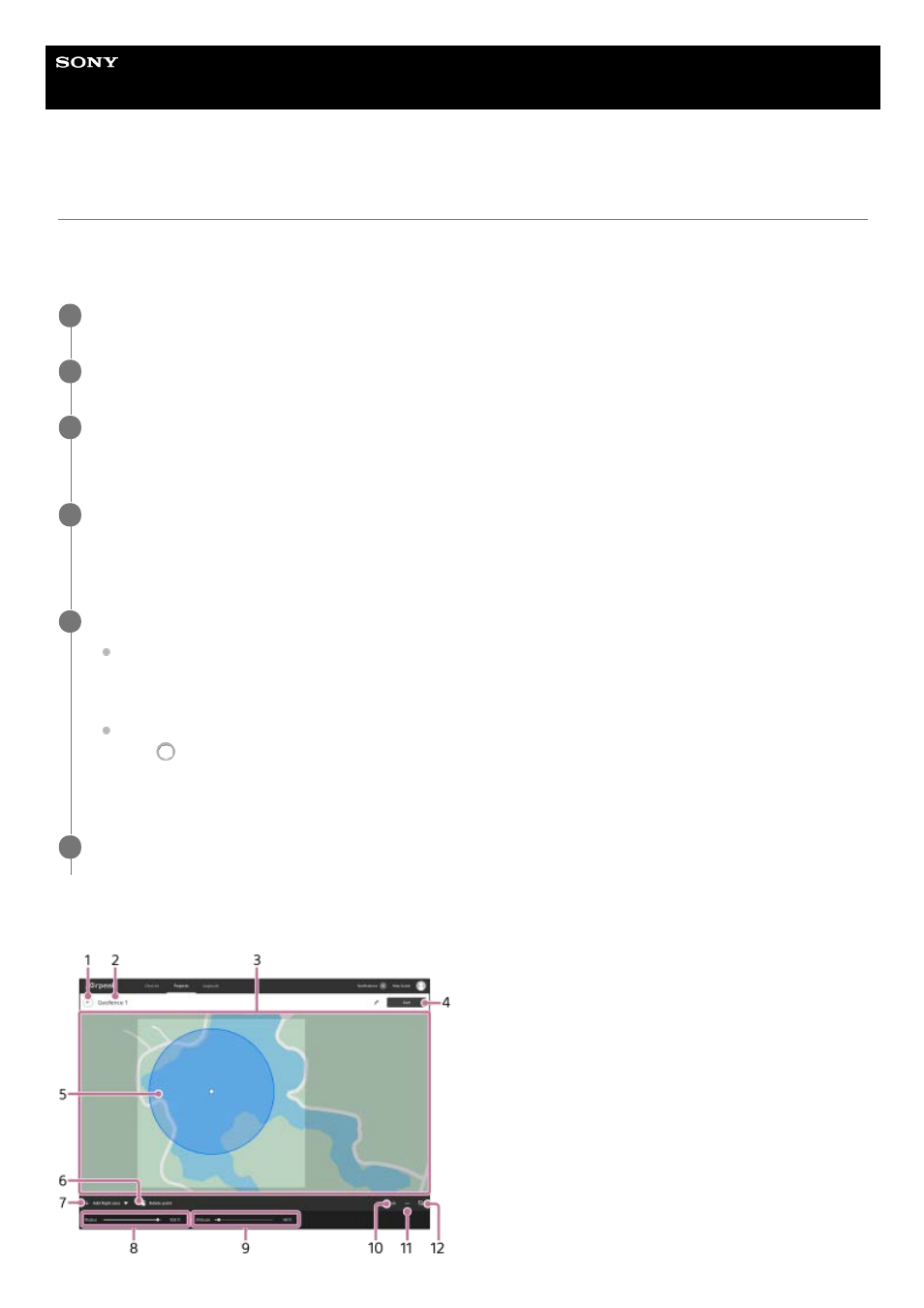
Geofence editing screen
Click on [Projects] on the “Airpeak Base” App Home page.
1
Click on the project for which you want to create geofences.
2
Click on [Add geofence] in the [Flight plans] tab, and then select [Create new geofence] from the menu.
The geofence editing screen will be displayed.
3
Click on [Add shape] at the bottom left of the screen and select [Circle] or [Polygon], and then click on the
map.
A circle or polygon will appear on the map, indicating a geofence zone.
4
Edit the geofence.
To edit a circle:
To set the radius and maximum altitude, click within the geofence zone, and then set the values at the bottom of
the screen. The same maximum altitude value applies to the entire zone within a circle.
To edit a polygon:
Drag
(Point) on the edge of the geofence zone to form the desired shape.
To set the maximum altitude, click within the geofence zone, and then set the value at the bottom of the screen.
The same value applies to the entire zone within a polygon.
5
Click on [Save] when you have completed editing. Enter the geofence name in the dialog, and then click on
[Save].
6
86