RISCO Group axesplus® MAP Editor User Manual
Page 30
Advertising
User Manual for MAP Editor
Uncontrolled when printed
© RISCO Group
22
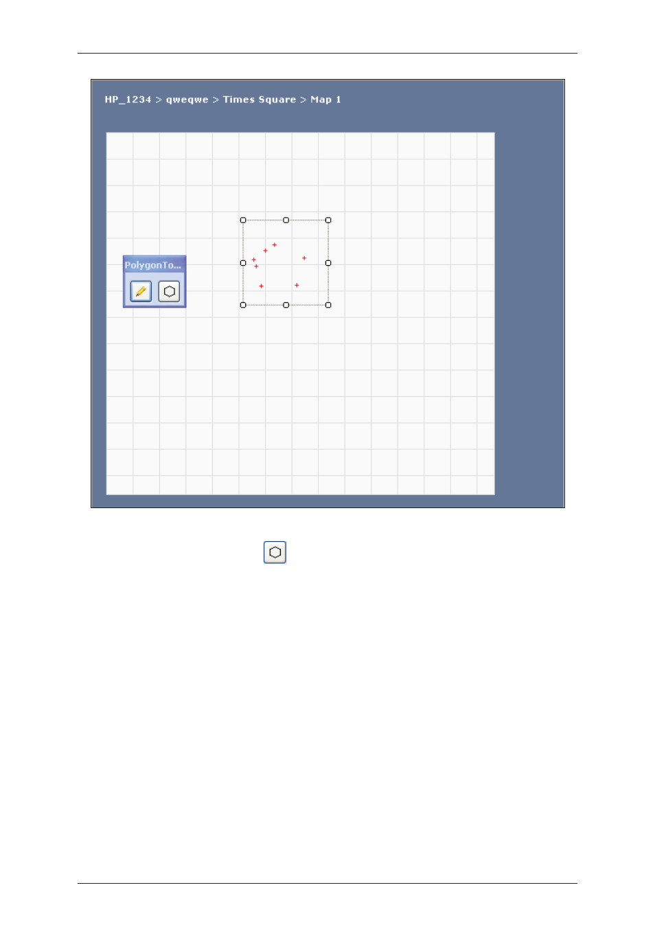
Figure 21: Draw a Polygon
10. After you mark all the points, click
(Draw Polygon). A polygon is drawn on the map. You may
draw zones as per the requirement.
11. After you draw a zone, the properties of the zone are displayed in the Properties pane. You can
change the values to suit your requirements.
12. To view the properties of the zone, click and select the zone. The following properties appear.
Advertising
See also other documents in the category RISCO Group Video surveillance systems:
- ProSYS 40 (48 pages)
- Risco Device Discovery (20 pages)
- NCache (24 pages)
- Reader AC500R11 (2 pages)
- axesplus® RDD (28 pages)
- ACMS (32 pages)
- ACMS (36 pages)
- Risco Services (68 pages)
- ACOS (28 pages)
- ACOS (88 pages)
- ACUS (28 pages)
- ACUS (56 pages)
- ACUS (525 pages)
- ACIS (111 pages)
- ACWS (36 pages)
- MAP Editor Installer (32 pages)
- Job Server Installer (32 pages)
- SafeWord OTP Server (36 pages)
- ProSYS – ACM (24 pages)
- 2- Way iWAVE PIR /PET (2 pages)
- 2- Way iWAVE PIR /PET (2 pages)
- 2- Way iWAVE PIR /PET (2 pages)
- BWare 2W WL PIR (2 pages)
- BWare QUAD AM G3 (2 pages)
- BWare QUAD AM G3 (2 pages)
- BWare QUAD AM G3 (2 pages)
- BWare DT AM Grade 3 (2 pages)
- BWare G2 515DTGL (2 pages)
- BWare K-Band DT Grade 2 (2 pages)
- DIGI-SENSE 412DT PET (2 pages)
- DigiSense Digital Detector RK415DTQ (2 pages)
- Digi 412PT (2 pages)
- IR Beam 71 Outdoor Detector (2 pages)
- RK-308 (8 pages)
- ShockTec 600SG3 (2 pages)
- ShockTec 601SM (2 pages)
- ShockTec Plus G3 Digital Shock (2 pages)
- Vitron Plus G3 Acoustic Glass-Break Detector Vitron (2 pages)
- Vitron Acoustic Glass-Break Detector (2 pages)
- VitronPlus Acoustic Glass Break Detector (2 pages)
- WL Carbon Monoxide (2 pages)
- WL Flood Detector (2 pages)
- WL Gas Leak (2 pages)
- WL Shock & Contact Detector WL T62 (2 pages)