The format key, The map info key, Navigational mode – Becker TRAFFIC ASSIST Z200 User Manual
Page 59
59
NAVIGATIONAL MODE
>>>
> D
> GB
> F
> I
> E
> P
> NL
> DK
> S
> N
> FIN
> TR
> GR
> PL
> CZ
> H
> SK
> Confirm your selection by pressing the
OK
key.
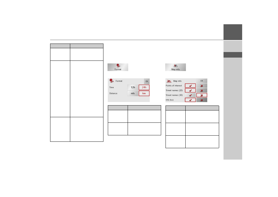
The Format key
Using the Format configuration window,
you can specify which units of measure-
ment to use for time and distance.
> Press
Format
in the settings menu.
The Format settings menu appears.
> Confirm your settings by hitting the
OK
key.
The Map info key
In the Map info settings window, you can
make settings for additional information
in the map display.
> Press
Map info
in the settings menu.
The Map info settings menu appears.
Setting
Meaning
Begin with
Select whether the stand-
ard map view is to be the
3D or the 2D view.
2D Autozoom
In the case of 2D view
navigation, select wheth-
er you would like the
auto zoom
low
,
normal
,
high
or
no auto zoom
view as standard.
With the Autozoom op-
tion, the zoom range var-
ies according to your
speed: When you drive
slowly, the scale is de-
creased. When you drive
faster, the scale is in-
creased.
2D View
In the case of 2D view
navigation, select wheth-
er the map should be ori-
ented
to the north
or in
the direction of travel
as
standard.
Setting
Meaning
Time
Press this field to toggle
between the 12-hour and
24-hour clock display.
Distance
Press this field to toggle
between the kilometre
and mile display.
Setting
Meaning
Points of in-
terest
If you activate this entry,
points of interest are dis-
played in the map.
Street names
(2D)
If you activate this entry,
all street names are dis-
played in the 2D map.
Street names
(3D)
If you activate this entry,
all street names are dis-
played in the 3D map.