Route configuration, Display options – Wavetronix Command Translator (CMD-DT) - User Guide User Manual
Page 43
42
CHAPTER 4 • ROUTES PAGE
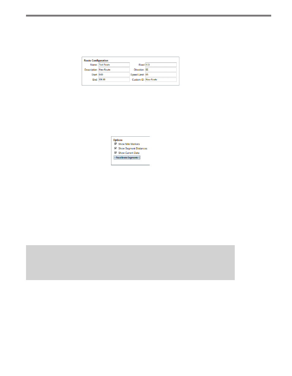
Route Configuration
The fields in the upper left (see Figure 4.4) list the eight primary attributes of the route,
which can be edited and saved.
Figure 4.4 – Route Configuration
Display Options
The display options for the route display can be accessed via the Options panel at the top
right of the screen.
Figure 4.5 – Options
˽
Toggling the Show Mile Markers option will turn on/off the gray mile markers at the
bottom of each segment boundary.
˽
Toggling the Show Segment Distances option will turn on/off the black distance totals
displayed in the middle of each segment.
˽
If data is available for the route from an already running trip time task (see the Creating
An Advanced Trip Time Task section later in this chapter), that data can be displayed
by checking the Show Current Data checkbox. (If no data is available, then “No Data”
will be displayed under each segment.)
Note
Details on segments and routes will be covered later in this chapter.
The Recalibrate Segments button will automatically create segments based on the position
of the included assets; this is provided as a way to more quickly create routes. When you
click on this button, the Recalibrate Segments window will open, giving you the following
two options:
˽
Automatically Assign New Segments To Assets – This maps the created segments to
the appropriate assets.
˽
Include Travel Points In Recalibration – Select this if you want each travel point to
mark a division point between segments.