Route data and overrides – Wavetronix Command Translator (CMD-DT) - User Guide User Manual
Page 53
52
CHAPTER 4 • ROUTES PAGE
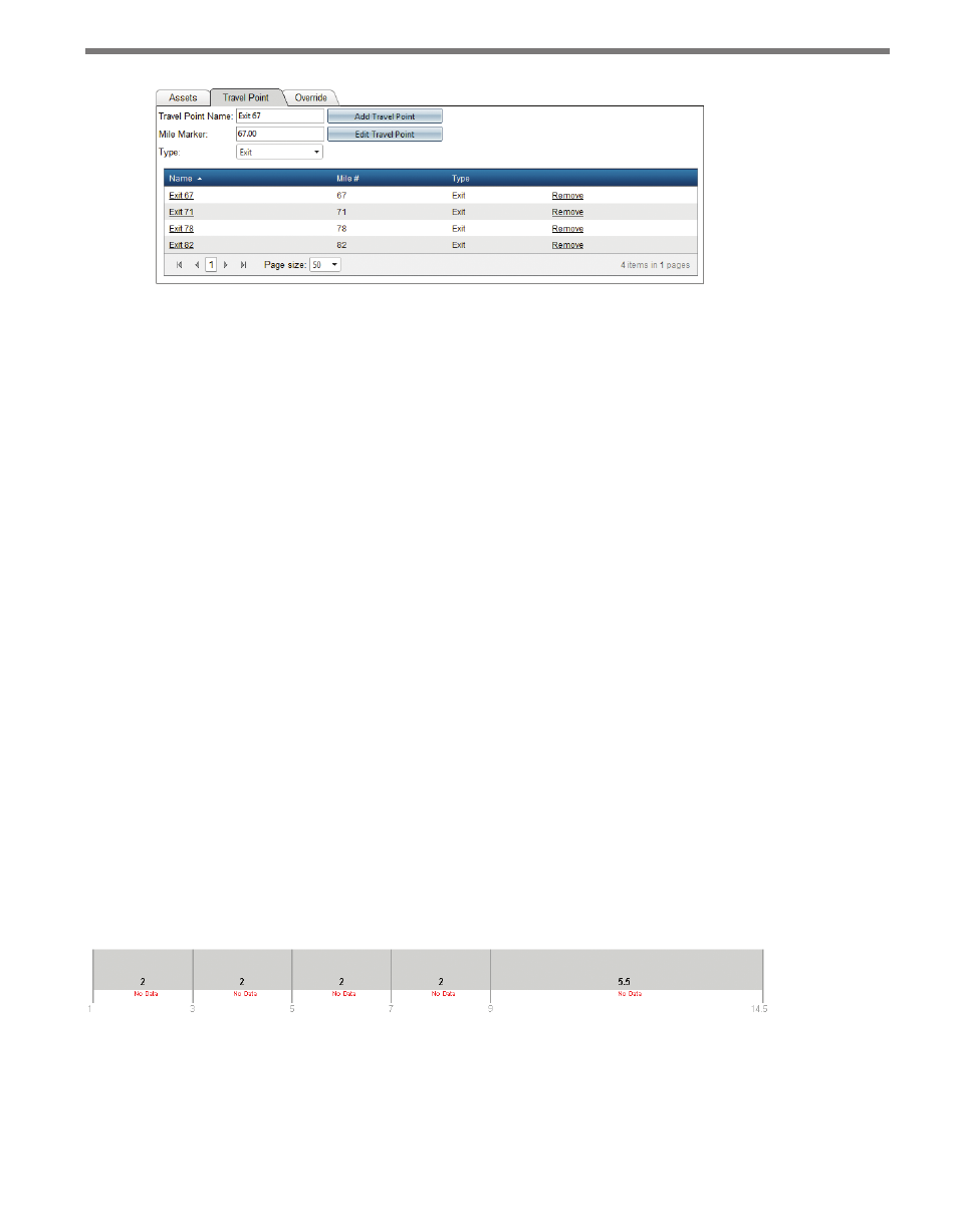
Figure 4.18 – Travel Point Tab
Travel points have the following characteristics:
˽
Name – Names must be unique
˽
Description – A description of the location (optional)
˽
Mile Marker – The mile marker location of the travel point
˽
Type – Either “entrance” or “exit”
Travel points are displayed on the route as a green circle drawn in the middle of the route
graphic. Selecting a travel point from the grid—by clicking on the name of the travel point
in the Name column—or clicking directly on the travel point circle will display the travel
point information in the text fields, allowing the selected travel point to be modified.
When calculating travel times, the Translator route processor will calculate individual trip
times between each entrance travel point, and each exit travel point that is further down
the route. This is useful in Web applications that allow users to choose from a selection of
locations to give them a specific travel time for their own personal travel.
Route Data and Overrides
Once a route has been successfully created and integrated with available data, the current
traffic conditions and trip times can be displayed within the route editor of the Translator
UI as well. To display current data, check the Show Current Data check box within the Op-
tions panel on the top right of the Edit Route page. If no data is currently available for the
route (the route travel time task has not been completed or is not running), each segment
will be marked with a No Data message (see Figure 4.19 for an example).
Figure 4.19 – No Data
If data is available for some or all of the route segments, the segments will be drawn with
an alternate color representing the current traffic speed, along with an additional text string
that shows the current speed and travel time for that segment.