Additional survce options, Localization, Additional survce options -98 – NavCom SurveCE Integration Rev.A User Manual
Page 100: Localization -98, Figure 57: equip menu – localization
Advertising
SurvCE™ Integration User Guide – Rev. A
3-98
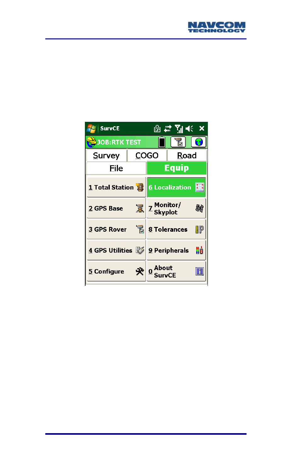
Additional SurvCE Options
Localization
Surveyors typically enter their own values
(coordinates) and arbitrary positions from a known
location.
Figure 57: Equip Menu – Localization
If a local coordinate system is the intended basis for
the survey, locate and store the local points in the
field. Then use Localization to compute the
relationship between the GPS coordinates and the
local coordinates. Thereafter, the local coordinates
will be available for view or staking.
The points used to define the localization need to
define the boundary area of the work site. Once
localization is applied, only points collected within the
boundary area should be considered valid.
Advertising