Gps information display – Canon EOS-1D X Mark III DSLR Camera (Body Only) User Manual
Page 705
Advertising
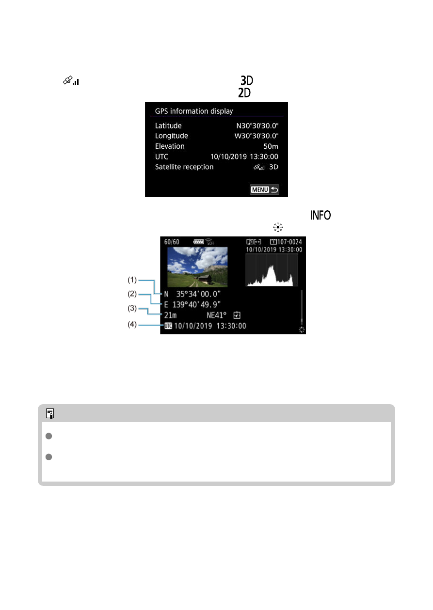
[GPS information display]
Shows acquired GPS information.
The <
> icon indicates signal conditions. When [
] is displayed, elevation is also
recorded. Note that elevation is not recorded when [
] is displayed.
You can check geotag information by displaying a shot, pressing the <
> button to
access the shooting information screen, and then pressing <
>.
(1) Latitude
(2) Longitude
(3) Elevation
(4) Coordinated Universal Time (UTC)
Note
Movies are tagged with the geotag information acquired when you start recording.
Note that signal reception conditions are not recorded.
Coordinated Universal Time, abbreviated as UTC, is essentially the same as
Greenwich Mean Time.
705
Advertising