Starfire, Description, Infrastructure – NavCom SF-3050 Rev.E User Manual
Page 179
SF-3050 GNSS Product User Guide
– Rev E
C-153
C .................................................... StarFire
Description
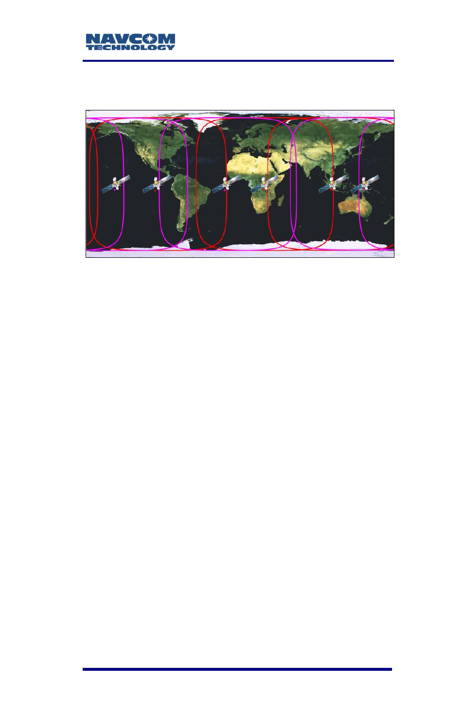
The StarFire Network is a global system for the
distribution of SBAS corrections giving the user the
ability to measure their position anywhere in the world
with exceptional reliability and unprecedented
accuracy of better than 5cm (2 inches). Because the
SBAS corrections are broadcast via INMARSAT geo-
stationary satellites, the user needs no local
reference stations or post-processing to get this
exceptional accuracy. Furthermore, the same
accuracy is available virtually anywhere on the earth's
surface on land or sea from a 10 degree look angle,
due to the worldwide coverage of these geo-
stationary satellites.
Infrastructure
The system utilizes the GPS satellite system, L-Band
communication satellites, and a worldwide network of
reference stations, to deliver real-time high-precision
positioning.