1 create an interactive map, Create an interactive map, Table 3.29 – RLE FMS V.1.13 User Manual
Page 115: Upload the map image
rletech.com
FMS User Guide
115
3
Web Interface Configuration
3.4.27.1 Create An Interactive Map
Creating the interactive map requires access to several pages within the FMS’s Configuration
menu.
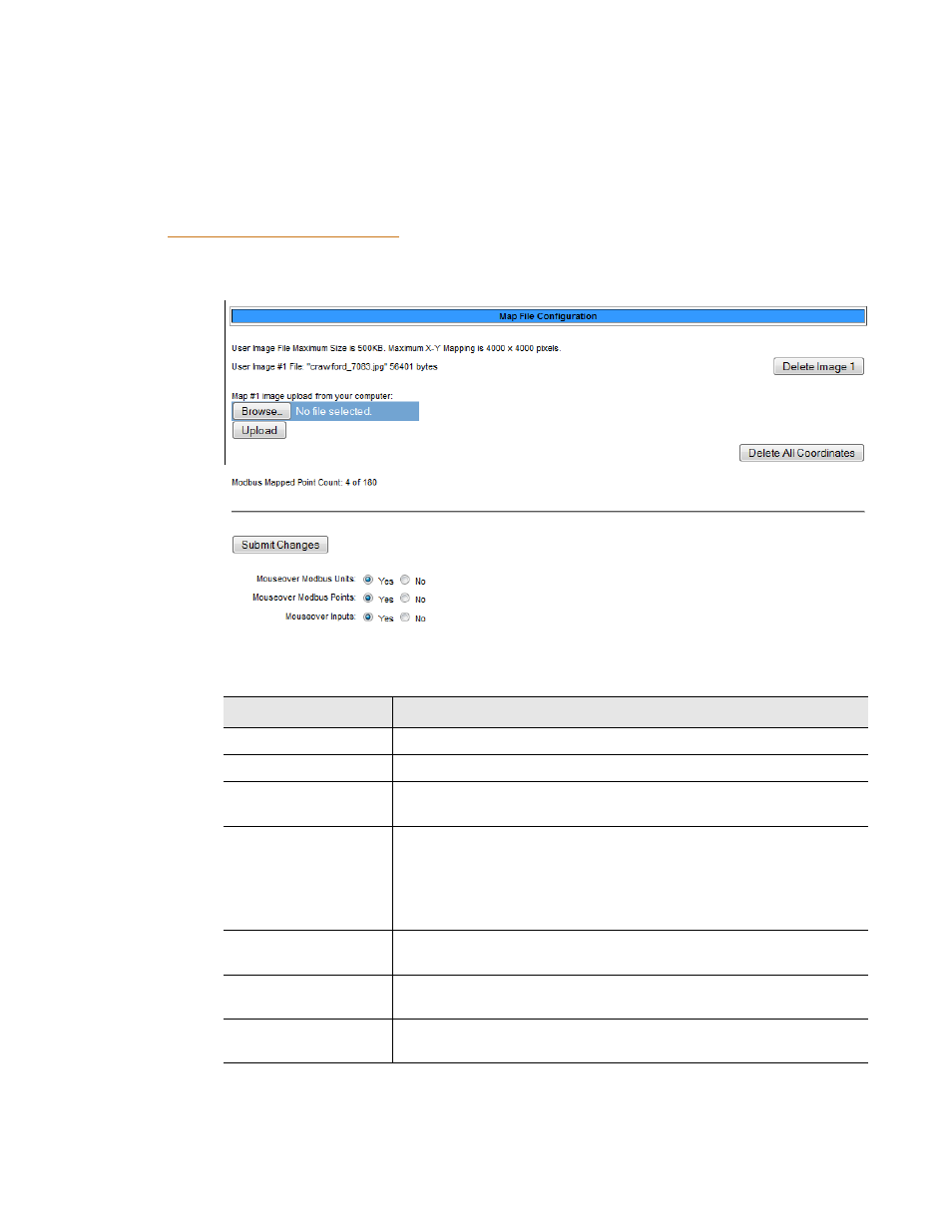
Upload the Map Image
To begin the mapping process, access the Configuration>Map page and upload your map
image. Options on the Map page are as follows:
Figure 3.53
Map Configuration Page
Option
Description
Browse
Click this button to select the map image on your computer.
Upload
Upload the selected image.
Delete Image #
The FMS can accommodate one map at a time. This button allows
you to delete a map that is already uploaded to the FMS.
Delete All
Coordinates
If you have previously uploaded a map to the FMS, you may also
have mapped coordinates for your monitored points and
equipment.
Click this link to delete all previously mapped coordinates.
Mouseover Modbus
Units
Select Yes if you’d like descriptive information to pop up when you
mouseover Modbus Units on the map.
Mouseover Modbus
Points
Select Yes if you’d like descriptive information to pop up when you
mouseover Modbus Points on the map.
Mouseover Inputs
Select Yes if you’d like descriptive information to pop up when you
mouseover Inputs on the map.
Table 3.29
Map Configuration Page Options