NavCom StarUtil Rev.E User Manual
Page 18
STARUTIL User Guide Rev. E
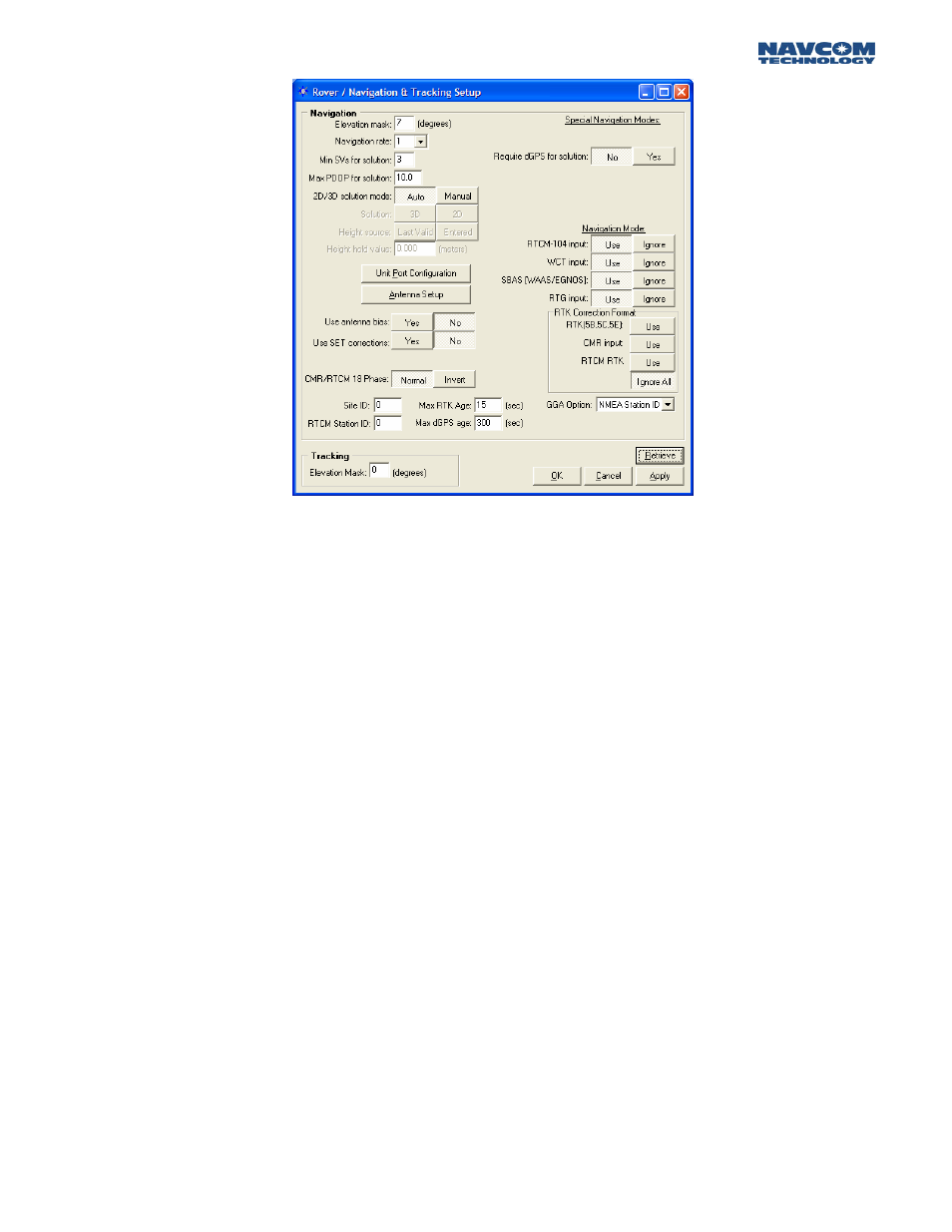
Figure 15: Rover Navigation & Tracking Parameters Setup
The Navigation Elevation Mask selects the elevation angle the receiver starts processing GPS data
from the satellites. The default is set to 7 degrees because GPS measurements of satellites at lower
elevation tend to deteriorate accuracy.
The Navigation Rate is the number of Navigation Solutions per second. The default rate is 1 Hz and
can be increased up to 25 hz as a purchased option.
The Navigation Rate of the 0xB1 message is changed here and NOT on the NCT Message
Output list. Attempting to change the Nav Rate in the NCT Message Output list will delete the
0xB1 message from the output list.
The minimum amount of satellites required for navigation is a user input value =>3. The default is 3
and denotes a 2 dimensional navigation solution. If height solution is needed, an additional satellite
must be manually entered bringing the total to 4. Obviously, the larger the number of satellites
required for navigation, yields a longer period of time before position output
The default setting for Max PDOP is 10. The quality of GPS data is dependent on the geometry
between the receiver and satellites; this includes the number of satellites that can be "seen" by the
receiver and the angle between the receiver and satellites. A satellite near the horizon usually
provides a lower quality signal because of greater atmospheric interference and the increased
likelihood of the signal reflecting from surface features, this is known as "multipath" error. The effect
of geometry on GPS quality is measured by PDOP (position dilution of precision). PDOP is the
overall measure of the precision obtainable with a given satellite geometry. For example, a PDOP of
4 or less yields excellent precision, a PDOP between 5 and 7 is acceptable and a PDOP of 7 or more
is considered poor.
A 2D solution is an altitude hold mode. This typically indicates that the receiver is navigating using
only 3 satellites, and the altitude component is a manually entered valued. This altitude value used
can either be the value entered or the last computed altitude. A 3D solution typically indicates that
the receiver is navigating using 4 or more satellites. When the 2D/3D button is in the Auto mode,
3 - 17