Canon EOS-1D X Mark II DSLR Camera (Body Only) User Manual
Page 218
Advertising
Acquiring GPS Signals
218
1
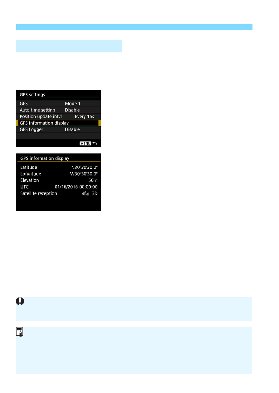
Check the [GPS] setting.
Check that [
GPS
] is set to [
Mode 1
]
or [
Mode 2
].
2
Select [GPS information display].
X
The GPS information will be
displayed.
3
Take the picture.
The image will be geotagged with the
location information.
Viewing GPS Information
Generally, elevation is not as accurate as latitude and longitude due to the
nature of GPS.
The <
A
> icon indicates signal conditions. When <
C
> is displayed, the
elevation is also recorded. Note that the elevation cannot be recorded
when <
B
> is displayed.
UTC (Coordinated Universal Time) is essentially the same as Greenwich
Mean Time.
Advertising