Geotagging information – Canon EOS-1D X Mark II DSLR Camera (Body Only) User Manual
Page 219
Advertising
219
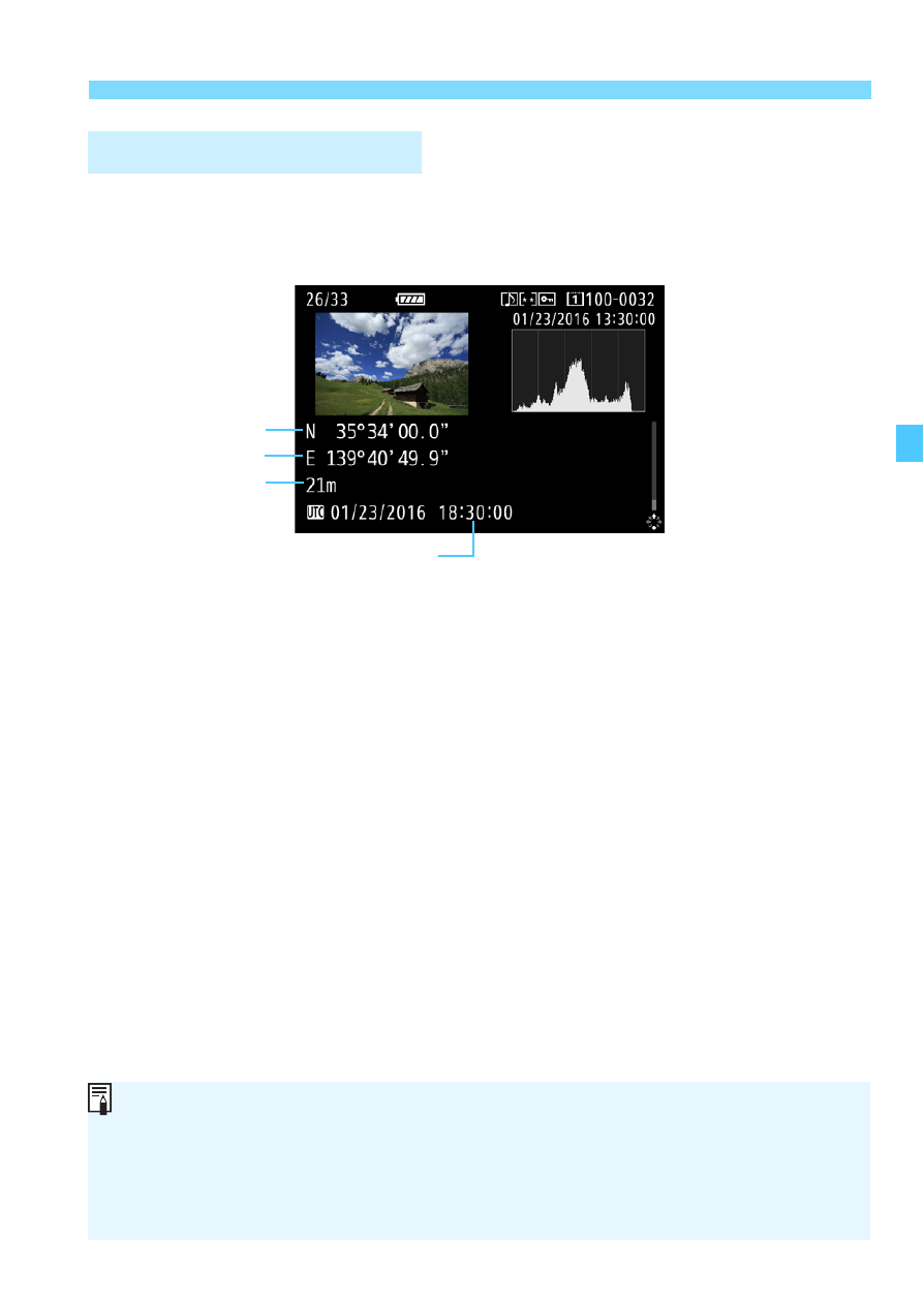
Acquiring GPS Signals
Play back the images and press the <
B
> button to display the
shooting information screen (p.347). Then tilt <
9
> up or down to check
the geotag information.
Geotagging Information
Latitude
Elevation
Longitude
UTC (Coordinated Universal Time)
When you shoot a movie, the GPS information at the time when shooting
begins is recorded. Note that signal reception conditions are not
recorded.
Shooting locations can be viewed on a map displayed on a computer,
using the Map Utility (EOS software, p.552).
Advertising