Point radius, Starfire satellites, Before uploading a starfire license – NavCom StarUtil-3000 Rev.A User Manual
Page 75: Figure 90: starfire navigation mode on, Table 8: starfire satellites, Figure 90), W (see figure 90)
StarUtil-3000 User Guide – Rev A
Point Radius
This feature applies only to receivers with a Land Only StarFire license. The Point Radius
definition is separate from the StarFire license. It allows the use of StarFire if the user is outside
the boundary lines of a Land Only StarFire license, but on a land mass (i.e., an island).
The user must provide the coordinates to NavCom Customer Service for the Point Radius
definition. NavCom provides StarFire use at the coordinates and within a determined radius.
The Point Radius definition is only for one point and radius circle.
StarFire Satellites
Table 8: StarFire Satellites
Network Satellite
ID
Longitude
Satellite
Name
Uplink Site
402 97.65W
PAC-E
Laurentides
609 109E
IND-E
Perth
Net 1
525 25E IND-W
Burum
358 142W
PAC-C
Santa
Paula
643 143.5E
PAC-W
Auckland
Net 2
484 15.5W
AOR-E
Southbury
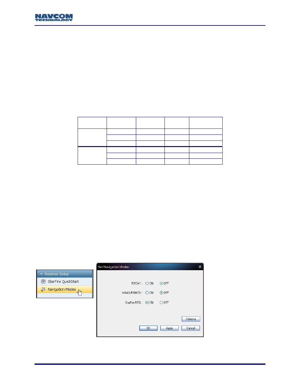
Before Uploading A StarFire License
Before uploading a StarFire License, either by data cable or Over The Air (OTA) StarFire
Licensing, ensure that the receiver is configured for StarFire. The navigation mode, StarFire
RTG, must be set to ON in the Set Navigation Modes window to enable StarFire navigation.
Refer to Figure 90 for the steps below:
Click Navigation Modes on the Receiver Setup menu. The Set Navigation Modes window
opens.
Confirm that StarFire RTG is set to ON. If not, click ON next to StarFire RTG, and click the
Apply button to enable StarFire navigation.
Click the Retrieve button to view the current navigation modes from the receiver.
Figure 90: StarFire Navigation Mode ON
7-73