Gpgll – NavCom LAND-PAK Rev.N User Manual
Page 176
Technical Reference Manual Rev. N
Blk = All;
Blu = IOP w/Internal Radio
;
Red = IOP & LBM
;
Grn = Engine only
174
$GPGLL
This output message reports geographic position (latitude and longitude) information and is in
compliance with NMEA-0183 Standards version 3.0.
Output Format:
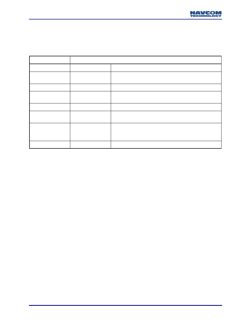
$GPGLL,lat,N/S,lon,E/W,time,status*checksum
Field#
Field Name
Description
F1
Lat
Latitude in degrees and decimal minutes
(ddmm.mmmmmm) (0000.000000 to 8959.999999)
F2
N/S
Direction of latitude (N=north, S=south)
F3
lon
Longitude in degrees and decimal minutes
(dddmm.mmmmmm) (00000.000000 to 17959.999999)
F4
E/W
Direction of longitude (E=east, W=west)
F5
time
UTC time for position fix in hours, minutes, seconds
(hhmmss.ss) (000000.00 to 235959.99)
F6
status
Status
V = void (invalid data)
A = active (valid data)
F7
Checksum
Example: $GPGLL,3713.870070,N,12148.058706,W,032618.00,A,D*7C