Starfire window, Satellite locations window, Figure 119: starfire window – NavCom StarUtil-3000 Rev.G User Manual
Page 122: Figure 120: satellite locations window, Figure 120)
StarUtil 3000 User Guide
– Rev G
7-120
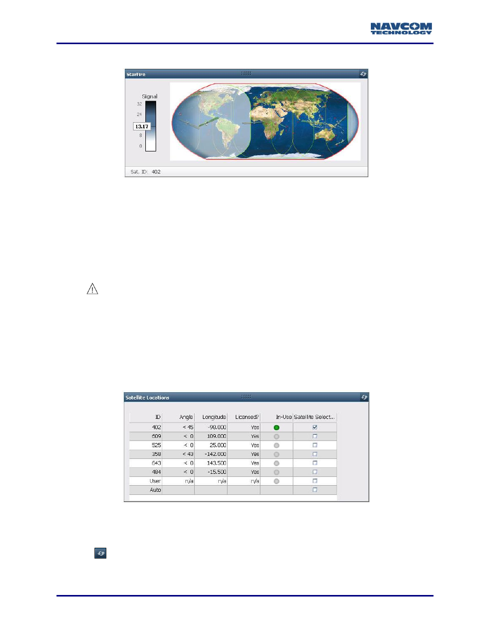
StarFire Window
Figure
119
: StarFire Window
StarFire Network Map: Displays the location and coverage of the StarFire satellite currently
selected in the Satellite Locations window. The Satellite ID is displayed in the lower left corner.
Signal Status Bar: Displays the signal strength of the tracked StarFire satellite:
< 0
Not Tracking
< 4
Weak
4-8
Good
> 8
Strong
The tracked StarFire satellite must be licensed to be In-Use (see Figure
).
Satellite Locations Window
Use the Satellite Locations window to manually or automatically select a licensed StarFire
satellite to use. The window lists all of the StarFire satellites in both StarFire Networks. In
addition, it displays information about the licensed user-defined satellite if it is defined, and
provides an automatic selection option. The Licensed? column indicates if a StarFire satellite is
licensed; i.e., available for use.
Refer to Table
to identify StarFire satellites by network.
Figure
120
: Satellite Locations Window
Check a box in the Satellite Selection column to manually select a licensed StarFire satellite
to use.
Click
(refresh). The In-Use column indicates if the satellite is locked in (see Table
).
There may be a slight delay until the satellite locks in.