Options, Figure 161: options area – NavCom StarUtil-3000 Rev.G User Manual
Page 171
StarUtil 3000 User Guide
– Rev G
11-169
Marker name: Allows up to 60 characters to identify the site where the data was collected.
Leap seconds: Allows the user to insert the current GPS Leap Second value, if known. If left
blank no leap second value will be reported in the RINEX ephemeris (navigation) file
header, or the RINEX Utility will use the leap second time reported in the raw data file (if one
exists). If the raw data file has a larger leap second value reported than the user entered
value, the raw data file value will be used instead.
Antenna height above marker: Allows the user to insert antenna base height above the survey
point. This adjustment can often be made in the Post Processing Software package as well.
Options
Figure
161
: Options Area
Completing the Options fields is optional. Check () the box above to modify an option.
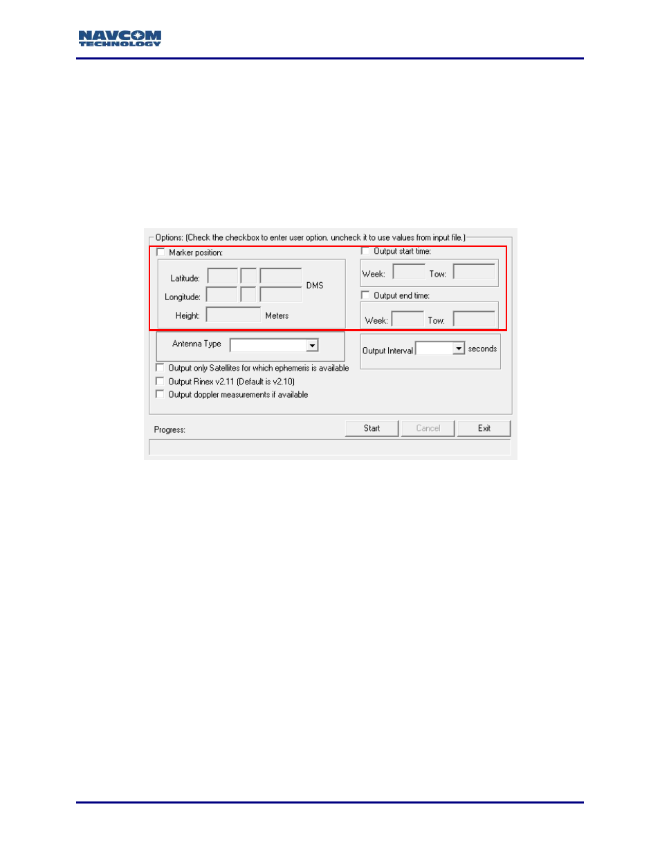
Figure 161 shows the Options area of the RINEX Utility.
Marker Position: Allows the user to input the Latitude, Longitude, and Height of the surveyed
position in Degrees Minutes and Seconds. These coordinates are converted to Cartesian
ECEF format and inserted into the “Approximate Position XYZ” area of the RINEX
observation file. If left disabled, the RINEX Utility will average the position based on the
range measurements received from the total number of epochs in the data collection period.
RINEX Utility conforms to RINEX Standard 2.10, which states that the Cartesian
ECEF position in the observation file header is WGS84. This means that the height
entered in the RINEX Utility must be WGS84. The RINEX Utility makes no attempt
to convert other datum heights to WGS84. Using height data from a datum other
than WGS84 will result in errors in the Z-axis.