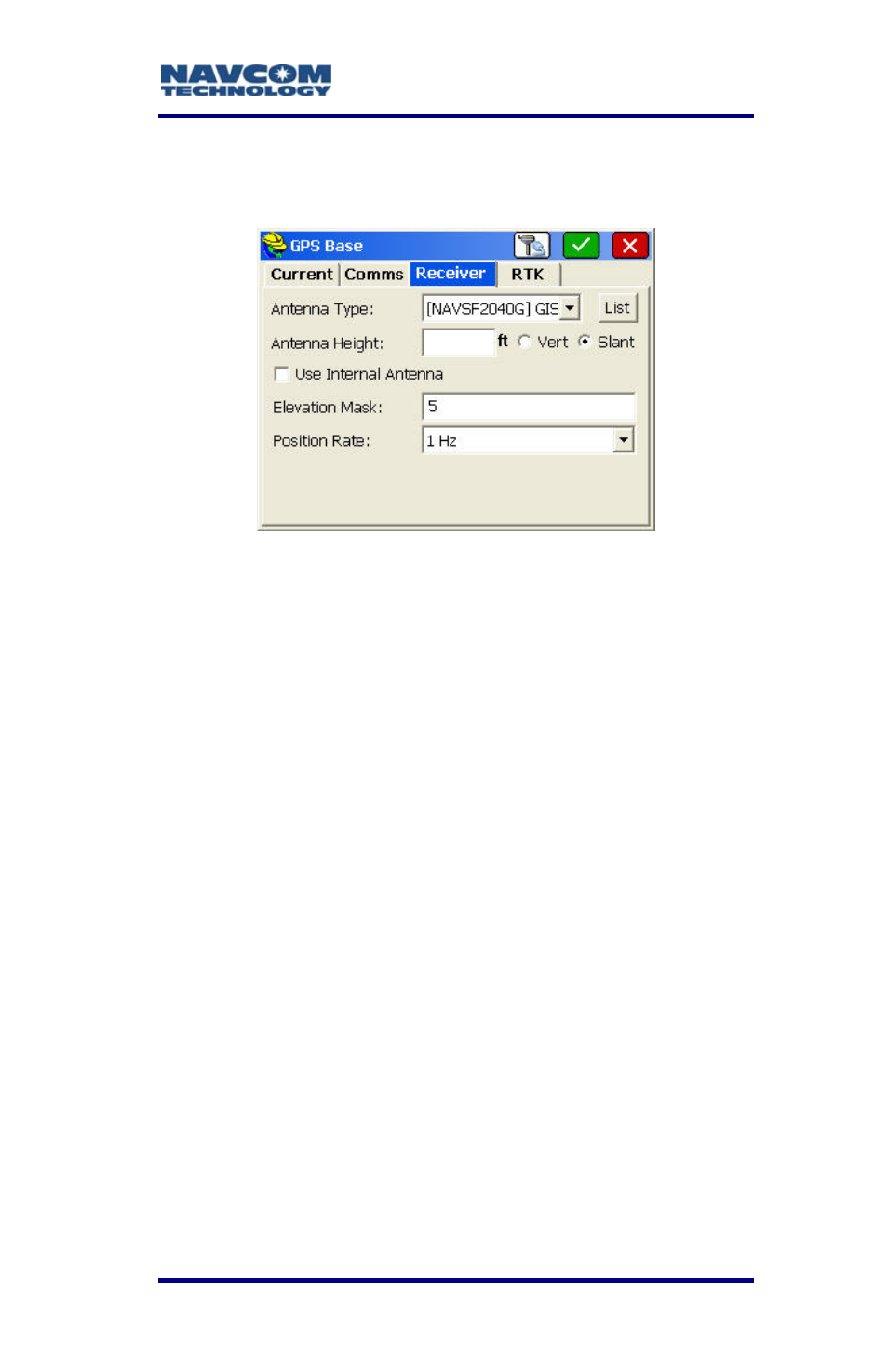
Figure 65: gps base submenu – receiver tab – NavCom SF-2040 Rev.C User Manual
Page 105
LAND-PAK™ User Guide – Rev. C
5-101
Refer t
4. Tap
o Figure 65 for the steps below:
the
Receiver tab.
bmenu – Receiver Tab
5. Set the options:
• Antenna Type: [NAVCOMSF2040G] GIS
• Antenna Height: Enter the height in the
current job units, and select Slant. Take the
slant height measurement at the center of the
black ring around the top of the receiver.
If working in feet, the height can be
checked by measuring in meters. Tap
the Antenna Height field. Enter the
this angle, no data will be transmitted to the
Figure 65: GPS Base Su
h
c
eight in meters, for instance 2.000m.
Tap outside the field. The meters are
onverted to feet.
• Elevation Mask: Enter the cutoff vertical angle
above the horizon. For any satellites below
rover for use in calculating positions.
The recommended setting for the
base receiver is 5 degrees; however,
the height of on-site obstructions will